Girvan through time
Girvan: river, shore and working town
Key dates
- About 450 million years ago
Ancient seas form the fossil-bearing rocks around Girvan.
- 1296
Johan, vicar of Girvan, appears in the records.
- 6 February 1329
Robert the Bruce conducts royal business in Girvan.
- 1668
The burgh charter authorises markets, fairs and a harbour.
Show all 8 dates Show fewer dates
- 1838
An inquiry counts 1,800 looms in the town and its vicinity.
- 1860
The railway opens from Maybole.
- 1888
The McKechnie opens to the public.
- 1982
The McKechnie reopens as a museum and gallery.
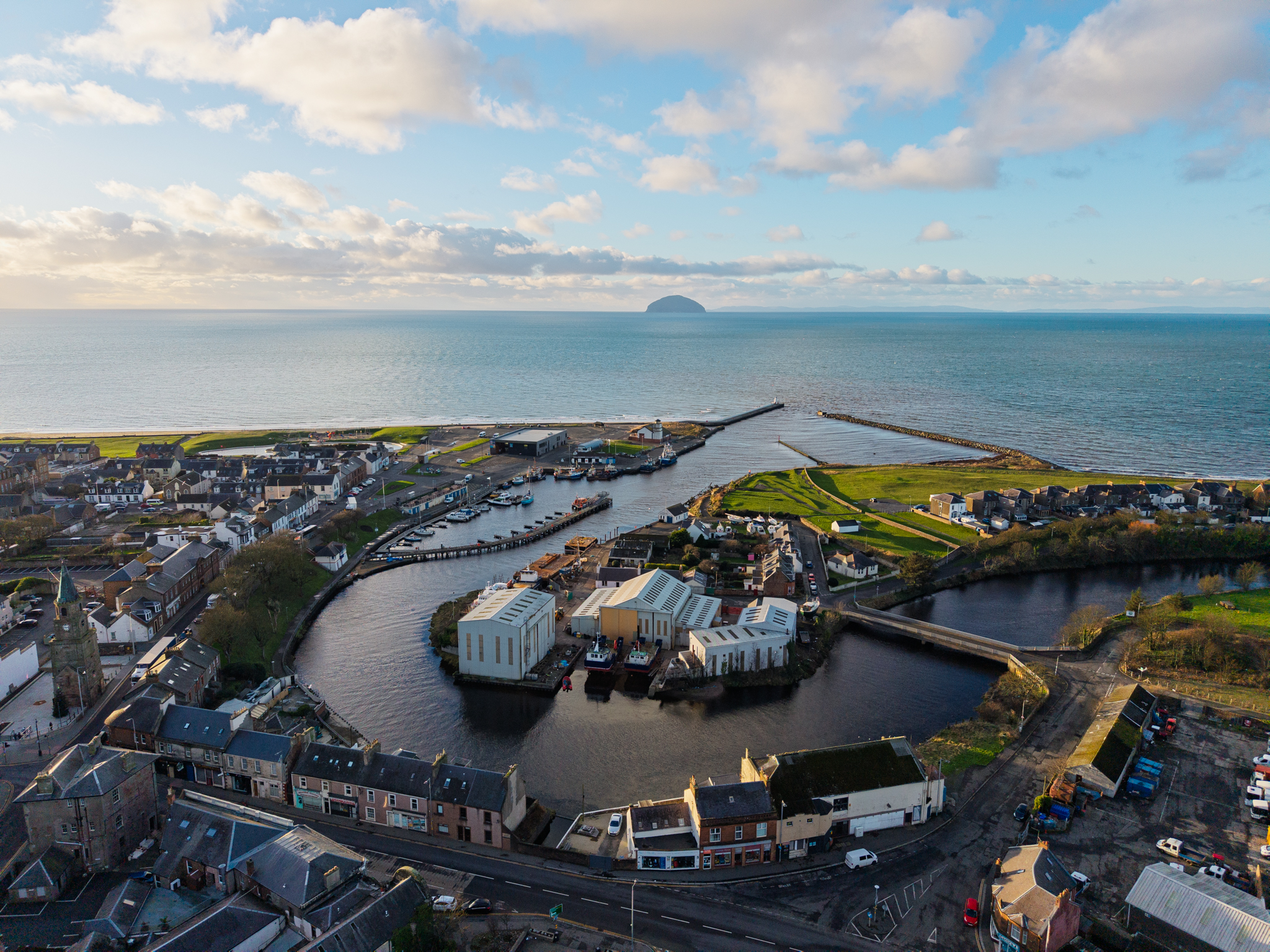
Girvan grew where a river reaches the sea. Its harbour connected the town to other ports, while roads inland brought it into the farming country of Carrick. Weaving filled houses with work. The railway carried goods and holidaymakers, and later factories drew on the town’s labour. The places left by those changes are still close together: the harbour, Stumpy, the McKechnie and the streets behind the shore.
The history beneath them reaches much further back. Around Girvan, fossil-bearing rock records ancient seas, and excavated fields preserve buildings made thousands of years before the town appears in writing.
Before the town
Much of the district’s geological importance comes from rocks formed in the Ordovician period, roughly 450 million years ago. Marine creatures, including trilobites and graptolites, left remains in sediments that became rock. Later movements of the earth folded and displaced those layers; ice and changing sea levels helped shape the coast we recognise.[1]
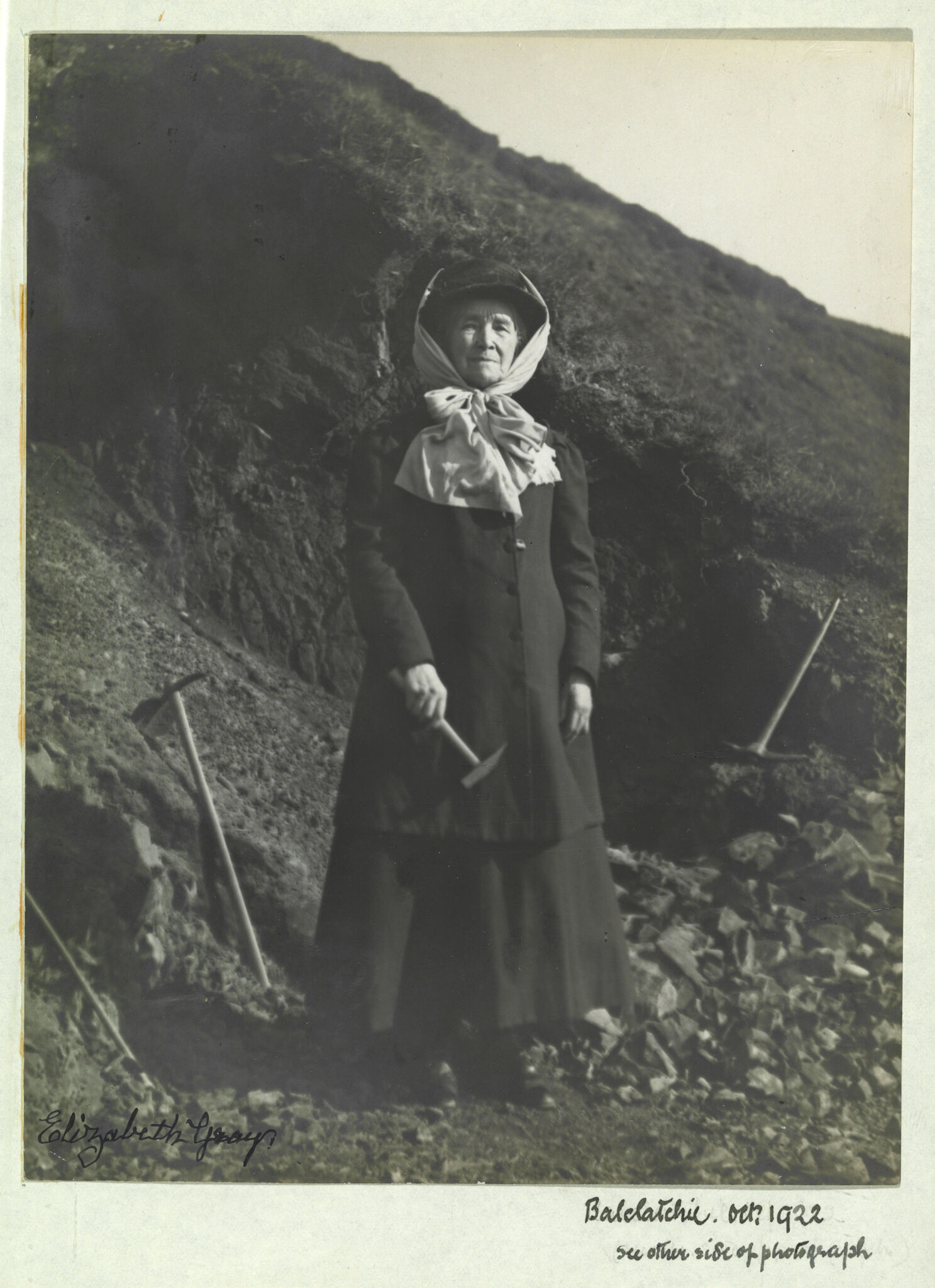
Elizabeth Anderson Gray and her family collected fossils from this ground during the nineteenth and early twentieth centuries. Her careful recording made the specimens useful to specialists studying the animals and their succession through the rocks. Material from Girvan entered museum collections and scientific descriptions far beyond Ayrshire.[2]
At the Curragh, five kilometres north-east of Girvan, excavation before development at the distillery uncovered a different record. In the earlier fourth millennium BC, people set substantial oak posts into a large enclosure. Much later, households built roundhouses on the higher ground. A small enamelled brooch, made in the Roman world in the late second century AD, was found in a palisade ditch.[3]
Three grain-drying kilns followed the houses. One probably belongs to the early medieval period; the other two remain undated. Long gaps separate the phases, but the remains show people returning to this ground to build and work across thousands of years.[3]
Girvan in medieval Carrick
Turnberry was a seat of the earls of Carrick, and Crossraguel Abbey was an important religious landholder in the district. Girvan belonged to this landscape of estates, churches and courts. In 1296, the record of submissions to Edward I named Johan, vicar of the church of “Garuan”.[4]
Ten years later, Girvan appears in military correspondence. On 25 July 1306, Henry de Percy ordered two engines of war to be sent by boat to Garvan in Carrick. By August, another letter reported engines sent to Percy at Loch Doon. The correspondence names Girvan as the intended coastal destination.[5]
Robert the Bruce conducted royal business here on 6 February 1329. Three acts dated at Girvan provided for the Blackfriars at Ayr, instructed the chamberlain to pay them and confirmed Aberdeen’s liberties. The visit formed part of the king’s final journey through Carrick and Galloway, four months before his death.[6]
Knockcushan has its own history as a court place. A royal grant preserves an account of a hearing held there in 1540, and a later description distinguishes Carrick’s head courts at Knockoshin from its ordinary court at Maybole. Local tradition places Bruce’s court on the mound, although the acts of 1329 name Girvan without identifying a building or precise seat.[6][7]
A charter, markets and a council
The royal charter of 6 May 1668 erected Girvan into a burgh of barony. It authorised a seaport, fort and harbour, two weekly markets and two annual fairs. Parliament ratified the grant in December 1669.[8]
These were powers to develop a town. They did not bring a completed harbour or a working council into existence at once. Later accounts record a further grant in 1696, but place the effective use of the burgh’s powers in 1785. Girvan then had a council of ten and two bailies, with the estate proprietor retaining a veto over its decisions.[9]
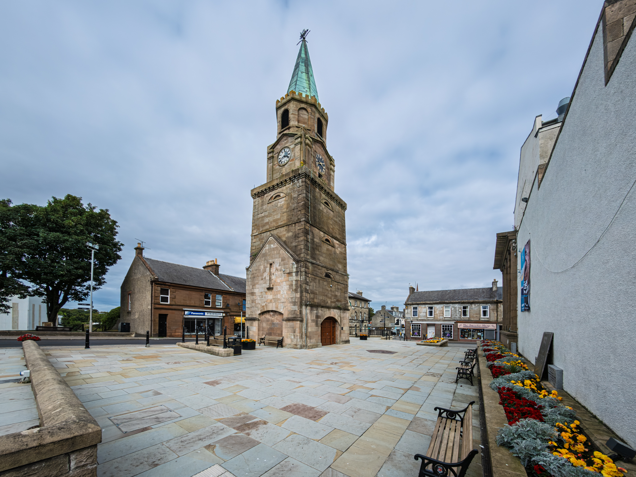
The town’s buildings gave local government a visible presence. The surviving Stumpy tower was built in 1825–27, with prison cells behind its walls. A sheriff’s certificate of 7 April 1827 declared the newly built jail fit to receive prisoners.[10]
Stumpy was already a local name. Writing in 1851, William Howie Wylie described an earlier lock-up known by it and said the marketplace remained “Stumpy Corner” after that building had gone. People still spoke of a prisoner being put in Stumpy. The familiar name continued across changes to the town’s buildings.[11]
Houses full of looms
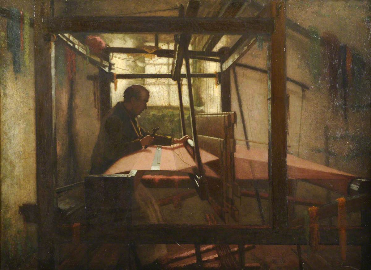
Handloom weaving helped Girvan expand. Agents supplied thread from Glasgow and Paisley; families wove cloth at home and sent it back for finishing and sale. Around the 1790s, roughly a hundred looms worked in Girvan. An official inquiry counted 1,800 in the town and its vicinity in 1838.[12]
The work brought people into Carrick, including families from Ireland. It also made household earnings depend on distant manufacturers and markets. Powered machinery increased competition, while rates for hand weaving fell and agents’ deductions reduced what workers received. The decline took decades: an occupied loom could still bring in too little to support a family.[12]
In 1863, Girvan’s relief committee was spending about £30 a week on a soup kitchen and stone-breaking work. Donations kept it going as demand increased. Some families left for Queensland; others continued to seek work at home. The railway had already opened, but better transport did not immediately replace the earnings lost from weaving.[13]
Harbour, railway and shore
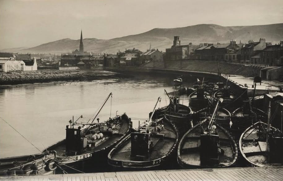
Girvan’s harbour needed repeated reconstruction, extension and dredging. The entrance served fishing boats and vessels carrying goods such as coal and grain. Reconstruction in 1869–70 was followed by extensions in 1881–83, including work associated with engineer Walter Robert Kinipple. Maintaining access to the sea was a continuing expense.[14]
The first railway opened for traffic on 24 May 1860, linking Girvan northwards through Maybole and Ayr. The southern route opened in stages in 1877: initially passengers continued from New Luce by coach, before through trains to Stranraer began that October.[15]
Visitors joined the town’s working traffic. The shore offered space for walking and recreation, and in January 1875 the Earl and Countess of Stair offered the council ground for a park at a nominal rent of one shilling a year. Their terms reserved it for recreation. Performers later entertained summer audiences at the Stair Park bandstand.[16]
Water, books and public rooms
The growing town needed services as well as connections. Girvan’s waterworks opened on 6 January 1883, bringing a new supply to public points in the town.[17]
Organised access to books preceded the McKechnie Institute: Girvan had a Mechanics’ Library by 1845. Thomas McKechnie’s bequest provided the larger building in Dalrymple Street, which opened to the public on 28 December 1888. People could enter freely, although borrowing books required a subscription.[18]
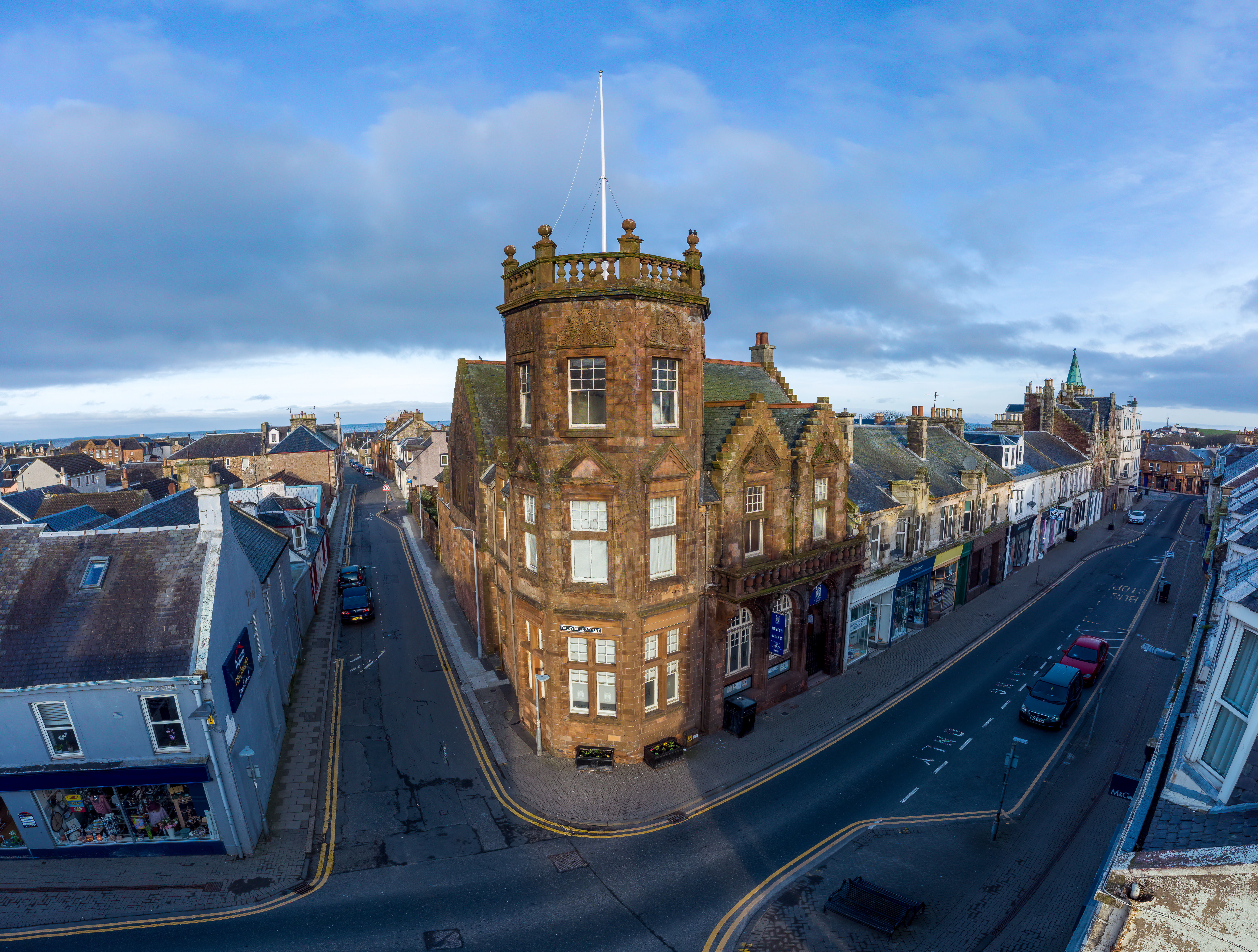
The weaver and poet Robert Cadden thanked an unnamed friend for giving him a membership ticket. His poem celebrates the books now available to him, from novels and poetry to geology, astronomy and history. It gives a personal account of what access to a library could mean.[19]
Seasonal work and war
The early potato harvest brought workers into the district from Scotland and Ireland. In June 1920, a strike interrupted the lifting. Alongside higher wages, workers wanted pay to continue when bad weather or a glut in the market stopped the work. The reported settlement provided six shillings a day irrespective of those interruptions.[20]
The First World War left names to be commemorated in Stair Park, where Girvan’s war memorial was unveiled in 1922. Names from the Second World War were added later. The park that had been secured for recreation also became a place of remembrance.[16]
The Second World War changed employment around Girvan. TNT production began at Grangestone in February 1943. Hundreds of women and men worked at the explosives factory, served by railway connections and water from the River Girvan.[21]
Stumpy had survived another kind of destruction shortly before the war. Fire gutted McMaster Hall in 1939 and destroyed the tower’s spire. The damaged hall remained for years. In December 1955 it was being demolished while the tower was preserved; an October 1957 report described Stumpy as almost restored.[22]
Work and buildings after the war
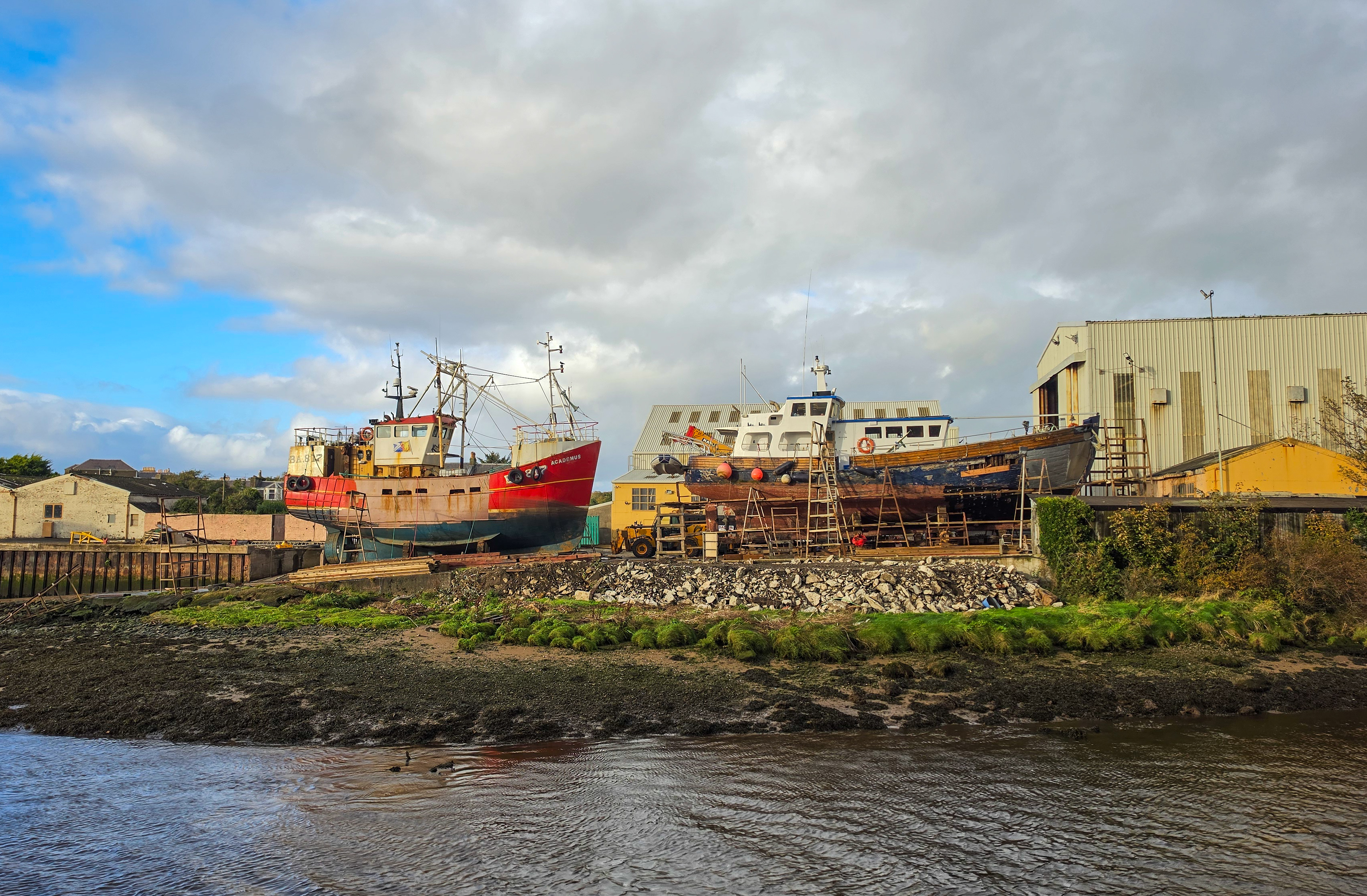
Noble’s boatyard began beside the river in 1946. Its first boat, Margaret Stephen, reached the water in February 1947 with the help of planks, rollers and local fishermen. The business developed slipways and covered building sheds, making and repairing vessels for customers around the western coasts.[23]
Manufacturing also broadened the town’s employment. A 1970 account described women making electronic components at Gordos and working at Inter-Alia Pharmaceutical Services. These factories linked local jobs to markets beyond Scotland, alongside the harbour trades and seasonal visitor business.[24]
Public buildings changed use as well. When the library left the McKechnie in 1975, Girvan Community Council helped secure a future for the Institute. It reopened on 8 August 1982 as a museum, gallery and community arts centre.[18]
The shore continued to acquire new facilities. Girvan’s indoor swimming pool opened in 1972, closed in 2009 and was later demolished. Its replacement, The Quay Zone, opened in April 2017 on the harbour-side site. Recreation remained part of the town’s life, with a new building serving it.[25]
References
[1] British Geological Survey, Shalloch Formation, and geological mapping of the Girvan district.
[2] R. J. Cleevely, R. P. Tripp and Y. Howells, “Mrs Elizabeth Gray (1831–1924): A Passion for Fossils”, Bulletin of the British Museum (Natural History), Historical Series 17(2), 1989, pp. 167–258.
[3] Jordan Barbour and Dave McNicol, Excavations at the Curragh, Girvan, Archaeology Reports Online 59 (2025), pp. 7–24, 42–45.
[4] Instrumenta Publica sive Processus super Fidelitatibus et Homagiis Scotorum, 1291–1296 (1834), p. 149.
[5] Joseph Bain (ed.), Calendar of Documents Relating to Scotland, II (1884), nos. 1808 and 1819.
[6] A. A. M. Duncan (ed.), The Acts of Robert I, King of Scots, 1306–1329, Regesta Regum Scottorum, V (1988), nos. 363–365, pp. 615–616; itinerary, pp. 155–157.
[7] Registrum Magni Sigilli Regum Scotorum, III, no. 2684, p. 620; Walter Macfarlane, Geographical Collections, II (1907), p. 16, Abercrummie’s account of Carrick.
[8] Registrum Magni Sigilli Regum Scotorum, XI, no. 1179, p. 594; Records of the Parliaments of Scotland, 1669/10/117, 23 December 1669.
[9] James Thomson, Girvan, Statistical Account of Scotland, XII (1794), p. 344; Peter M’Master, Girvan, New Statistical Account of Scotland (1845), p. 403, burgh history.
[10] William Eaton, jail certificate, 7 April 1827, reproduced in Stumpy Jail’s interior exhibition; RCAHMS, Tolbooths and Town-Houses: Civic Architecture in Scotland to 1833 (1996), pp. 96–97.
[11] William Howie Wylie, Ayrshire Streams (1851), p. 126.
[12] Reports from Assistant Hand-Loom Weavers’ Commissioners (1839), J. C. Symons’s report, pp. 3, 5, 19, 21, 37–38; Robert Heron, Observations Made in a Journey through the Western Counties of Scotland, second edition (1799), II, pp. 314–315.
[13] Ayrshire Express, 18 April 1863, p. 8, “Good News”; New Zealand Gazette, 4 July 1863, pp. 256–257, Girvan Hand Loom Weavers Emigration Society memorial.
[14] Historic Environment Scotland, Girvan Harbour, site 203289; Francis H. Groome, Ordnance Gazetteer of Scotland, Girvan entry; Ayr Observer and Galloway Chronicle, 12 March 1886, pp. 2–3.
[15] Glasgow Daily Herald, 22 May 1860, p. 4; North British Daily Mail, 24 September 1877, p. 8; Portpatrick Railway Company v Girvan and Portpatrick Junction Railway Company (1882), 19 SLR 394–399.
[16] Ayr Observer and Galloway Chronicle, 16 January 1875, p. 2; Kilmarnock Herald and North Ayrshire Gazette, 3 September 1909, p. 7; Imperial War Museums, Girvan Obelisk, WMR 13358.
[17] Evening Times, 6 January 1883, p. 3; Glasgow Herald, 8 January 1883, p. 9, Girvan waterworks opening reports.
[18] Ayr Observer and Galloway Chronicle, 1 January 1889, p. 4; New Statistical Account of Scotland, V (1845), Girvan, p. 619; South Ayrshire Council, “Celebrations at the McKechnie Institute”.
[19] Robert Cadden, Stray Threads from the Loom (1895), pp. 12–13, “To a Friend on Receiving a Membership Ticket for the M’Kechnie Library”.
[20] Edinburgh Evening News, 22 June 1920, p. 5; Sunday Post, 27 June 1920, p. 3.
[21] Historic Environment Scotland, Grangestone Explosives Works, Scottish Industrial Archaeology Survey note, 5 August 2024, citing MS8270/16.
[22] The Scotsman, 21 March 1939, p. 13, “8000 Gas Masks Ruined”; The Scotsman, 30 December 1955, p. 4, “Preserving Stumpy”; Sunday Mail, 27 October 1957, p. 5.
[23] Scottish Fisheries Museum, photograph record 1566; “Nobles of Girvan”, Find a Fishing Boat, 10 November 2016; The Scotsman, 14 July 1970, pp. 10–11.
[24] The Scotsman, 14 July 1970, pp. 10–11, J. Bruce-Watt, “Development plan pays dividends”.
[25] Milngavie and Bearsden Herald, 31 March 1972, p. 4, Morag M. Hart’s letter; South Ayrshire Council, Girvan Conservation Area Appraisal (June 2024), p. 12.
Image credits and enquiries
Images are included to illustrate Girvan and Carrick’s history for educational purposes. Sources and photographers are credited where known. If you hold rights in an image, please contact us so we can review its use, correct the credit or remove it.
Pass the story on