Harbour and working coast
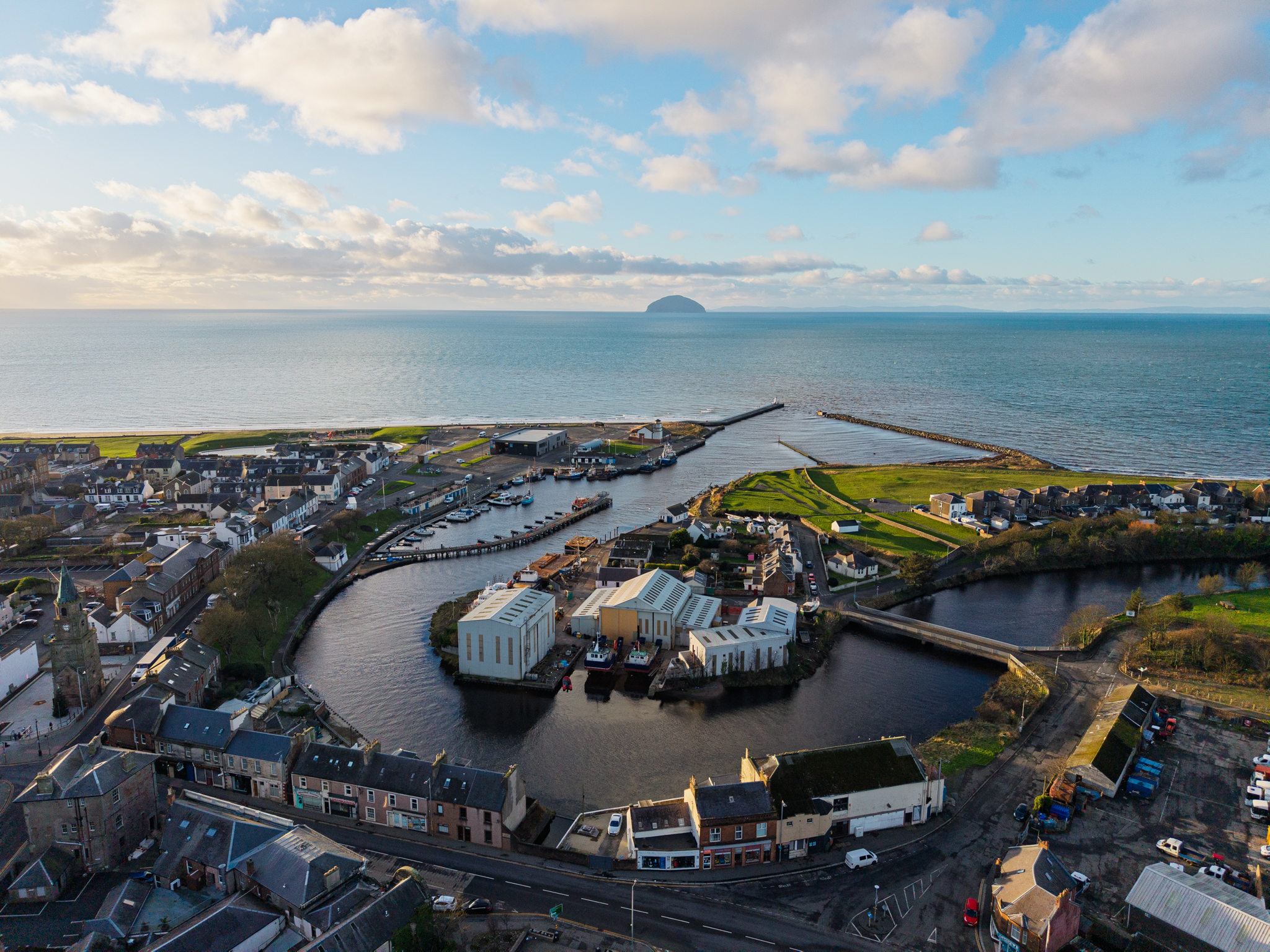
The harbour Girvan had to keep rebuilding
Key dates
- 1668
The burgh charter authorises a seaport, harbour and shore dues.
- About 1761
A short-lived herring fishery begins at the river mouth.
- 1865
Harbour commissioners are incorporated and the lifeboat station is established.
- 1869–1883
Reconstruction and extensions reshape the harbour entrance.
Show all 8 dates Show fewer dates
- 1946–1947
Noble’s yard begins work and launches Margaret Stephen.
- 1974
Noble’s yard builds Alliance.
- 1988
Work begins on a new breakwater.
- 2023
A dredging assessment sets out the continuing work of keeping access open.
Girvan · Harbour history
The Ordnance Survey's Ayrshire Name Book of 1855–57 described Girvan's pier in a single sentence:
‘Is composed of dry stone, no lime used in its construction in very bad Repair.’[2]
Fishing boats and trading vessels already depended on this harbour. A few years earlier, in 1847, the fishing station had supported 34 boats and 90 men, and vessels drawing ten feet of water could enter. Coal and grain passed across a quay that had improved the town's trade. The work had grown beyond the facilities available to it.[2]
Over the following decades, Girvan gained harbour commissioners, reconstructed piers, railway connections and a lifeboat station. Each improvement served people who needed to get out to sea, bring a catch or cargo ashore, or return safely when the weather changed. The harbour's usefulness depended on keeping those movements possible.
A town growing beside the river
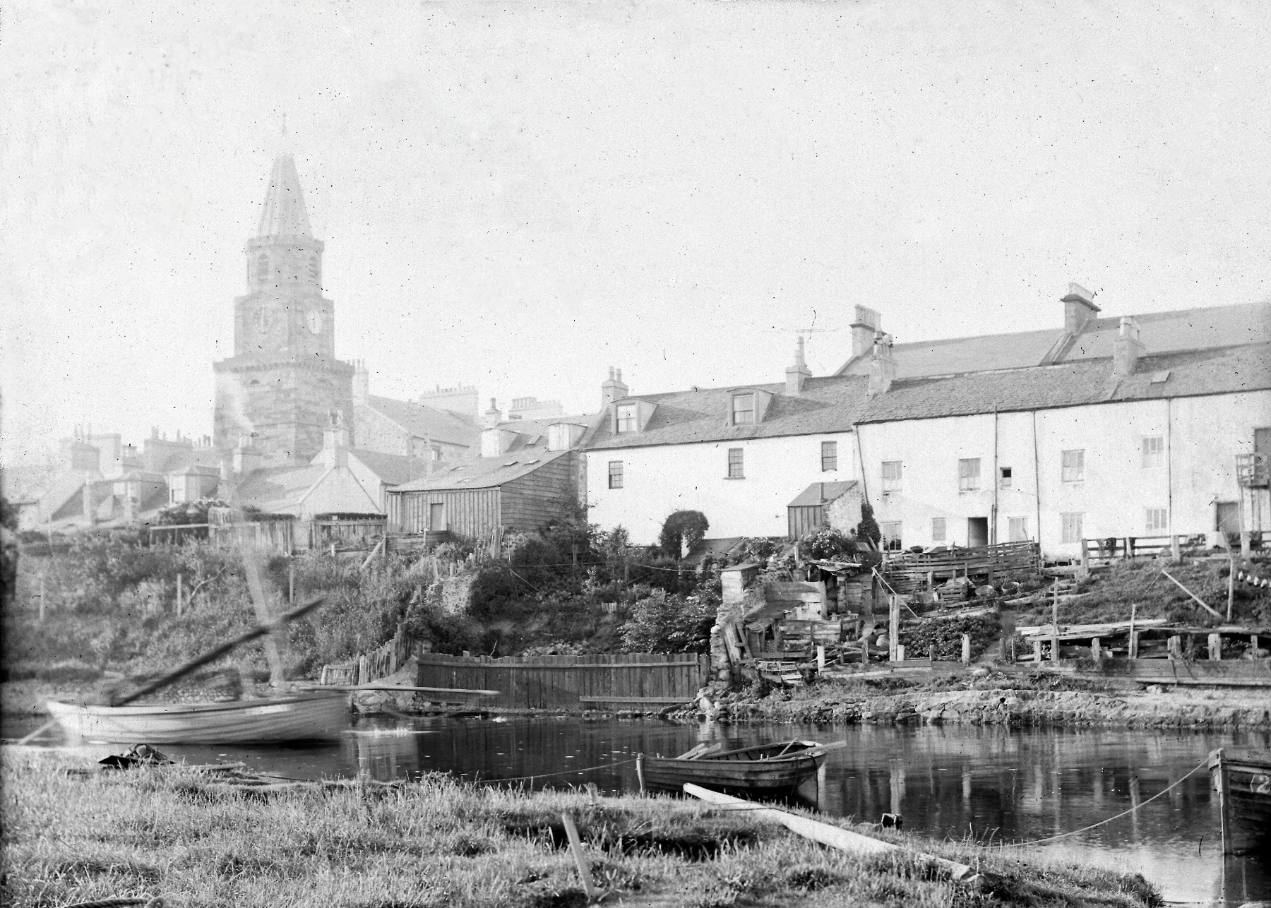
The Crown's charter of 1668 gave Girvan authority to build a seaport, fort and harbour at the mouth of the river. Markets, fairs and the collection of shore dues formed part of the same grant. These dues offered income from the vessels and goods using the shore, alongside the rights intended to develop the town's trade.[1]
The grant laid out an ambition. It would take generations of work to produce the harbour that later fishing fleets used.
Around the middle of the eighteenth century, Girvan had about fourteen houses and a hundred inhabitants, according to the parish minister, James Thomson. A herring fishery began at the river mouth around 1761 and lasted two or three years. Changes in farming brought displaced cottagers into the town, while smuggling added to its business. By the early 1790s, the population had grown to more than a thousand.[1]
Girvan grew through several kinds of work. Weaving occupied homes inland from the shore; fishing and trade brought boats to the river mouth. The brief herring boom belonged to this early growth, well before the larger harbour works of the nineteenth century.
At high water, the harbour in the 1790s had between nine and eleven feet of water. By 1837 a limited new quay was serving the coal and grain trade. There was business to be done here, but room for much better facilities.[1]
Building a working harbour
Plans followed the expanding trade. An 1842 harbour drawing recorded embankments and sections. When the railway from Maybole reached Girvan in 1860, another plan set out proposed harbour improvements and railway connections. Moving goods between sea and rail became part of the harbour's development.[3]
In 1865, Parliament incorporated the Harbour of Girvan Improvement Commissioners. Thomas Francis Kennedy of Dalquharran and Girvan Mains had a seat, alongside the holder of Bargany. The Glasgow and South Western Railway Company, Girvan's registered shipowners and the town council each appointed two representatives. These were the people and organisations responsible for taking the harbour's improvement forward.[3]
The commissioners could borrow up to £15,000 against the harbour works, property and income. Charges on vessels and cargo were to maintain the harbour and service its debts, with any surplus used for further improvements. The Duchesse de Coigny's existing anchorage rights were to end in return for £25 a year; a separate debt to her, capped at £600, was also provided for. Harbour users would help pay for the works through the dues they paid.[3]
The authorised scheme included a 390-foot south pier and a northern wall extending 700 feet seaward from the railway company's jetty. The commissioners could deepen the harbour and buy or hire dredging equipment.[3]
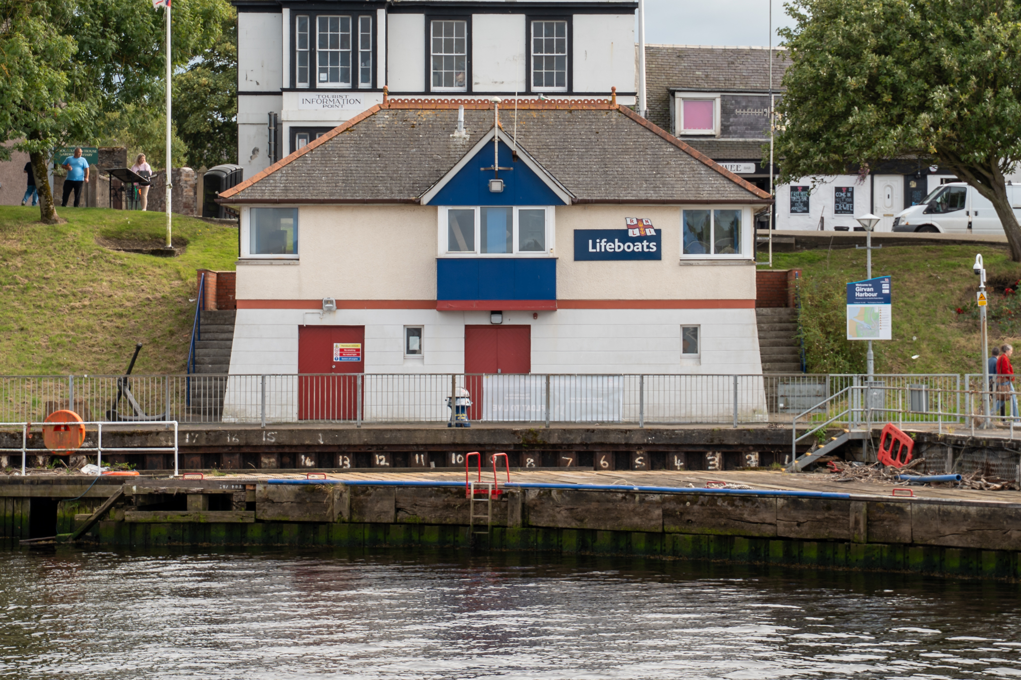
The same year brought a lifeboat station. The RNLI's first boathouse cost £190, on ground given by the Duchesse de Coigny. Rescue became an organised part of the waterfront's work, alongside fishing and trade. The 1909 Ordnance Survey map shows the Lifeboat House beside the dovecot at the northern end of the Green, on the shore west of Harbour Street.[6][22]
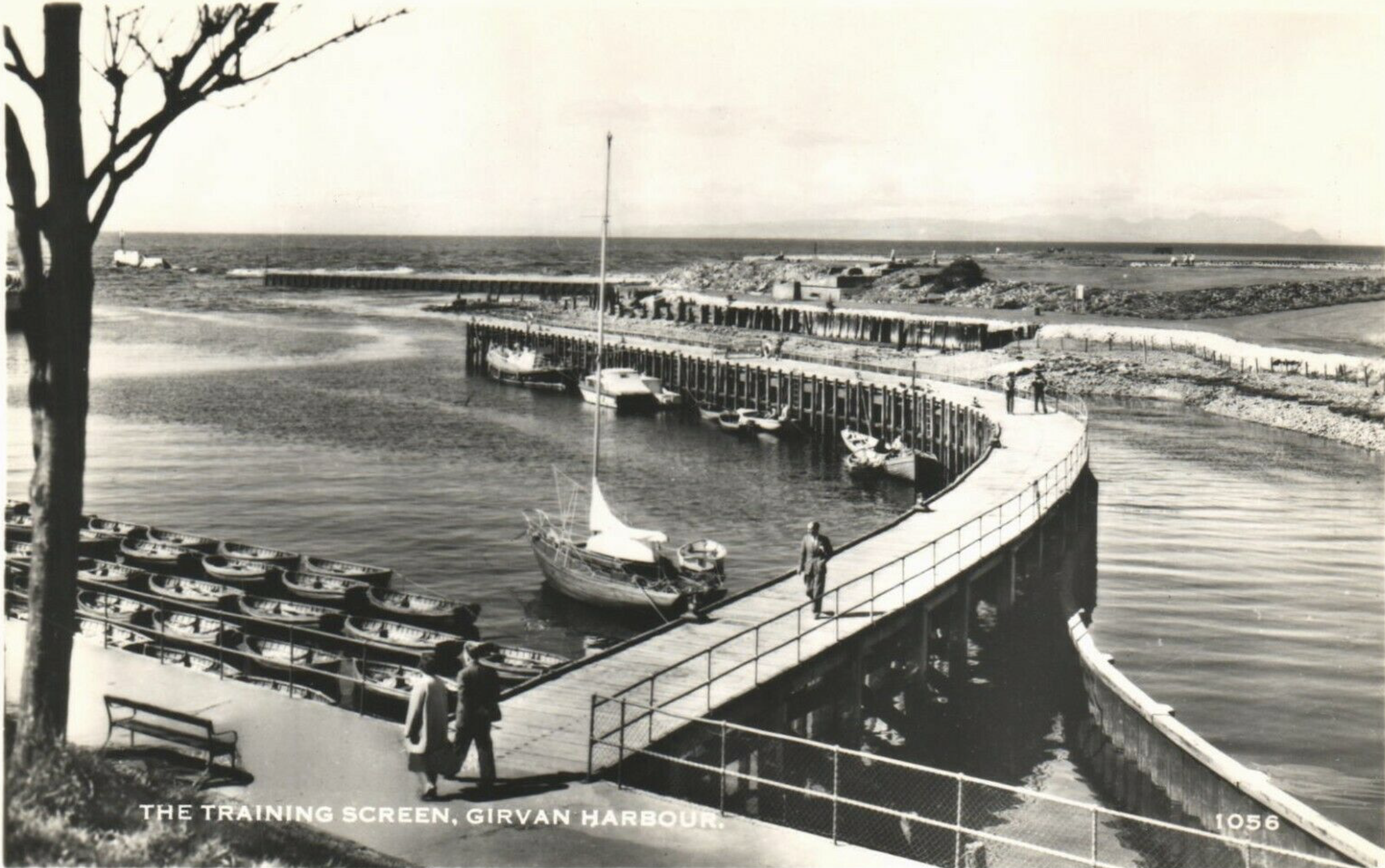
The harbour was reconstructed in 1869–70 and extended again in 1881–83. The 1880 improvement plans are attributed to the engineer Walter Robert Kinipple. The later scheme provided for a new pier from the west and a breakwater from the north-east, with an estimated cost of £12,000 in 1881. Its entrance was intended to resemble Eyemouth's, with substantial structures protecting the approach.[4][12]
Coal from railway wagon to ship
Coal was part of the harbour's business long before the railway arrived. The quay described in 1837 served coal and grain, and the railway subsequently brought wagons to the waterside. On the north bank, sidings connected with Girvan Goods and served chutes through which coal could be unloaded into ships. The railway and harbour formed successive stages of the same journey.[1][18][22]
The waterfront was shared by different trades. All depended on an entrance deep enough to use. Fishermen who paid harbour dues had particular reason to question what the improvements had achieved.
Getting the catch ashore
In March 1886, a newspaper account followed the fishing trade between Girvan and Ballantrae. Its reporter found handloom weavers still working in Girvan's landward street, while shops supplying the fishing trade served the waterfront. Boats were leaving Girvan for the fishing grounds off Ballantrae. The two trades existed beside one another as the town changed.[5]
During a Friday storm, snow, hail and darkness interrupted fishing and made the return difficult. Some boats sought shelter at Ballantrae and were hauled onto the beach early in the morning. Their crews travelled back to Girvan overland. Landing at another point on the Carrick coast could get men ashore when the journey home by sea had become too dangerous.[5]
Ballantrae had difficulties of its own. Hauling boats up the beach by steam was costly and slow. A better harbour and a railway were being urged as improvements. Girvan had the rail connection that Ballantrae wanted. The cost of using it was another source of complaint.[5]
One Ballantrae fisherman blamed railway charges for poor earnings. He described selling fish directly as well as through auctions, and argued that competition between buyers prevented lasting arrangements to hold prices down. The postmaster, Mr Wason, put more blame on fishing methods and wanted regulation. They agreed that the fishermen faced difficulties; they differed over the remedy.[5]
At Girvan, fishermen challenged the dues and complained that the promised four feet of water at low tide was lacking. The newspaper suggested an annual £1 payment per boat.[5]
The dispute reached Parliament on 19 March 1886. Mr Macfarlane pressed the fishermen's complaint; the President of the Board of Trade, Mr Mundella, relayed the commissioners' answer. They said the parliamentary plans required three feet, and that dredging the previous November had provided more. Winter conditions prevented further dredging at the entrance, where a shifting bar reduced the depth.[13]
Their reply also acknowledged that dredging had undermined 35 feet of an old boulder wall. Rebuilding was to follow when the weather allowed. Macfarlane maintained that fishermen still had to wait for half-tide to enter. Maintaining a deeper channel meant attending to the old walls as well as shifting sediment.[13]
The entrance remained a place where boats could need help. On 9 February 1894, the lifeboat Sir Home Popham stood by while the Ailsa steam-launch Nimrod and fishing boats came safely into Girvan. On 1 February 1898 it did the same for the returning fishing boats Sophia and Bonny Loch Ryan. Standing by a difficult entrance was part of rescue work too.[6]
In 1910, the lifeboat house was reconstructed on a new site at a cost of £800.[6]
Harbour improvements continued into the next century. The engineering partnership founded by Archibald Henderson and G. Gordon Nicol in 1919 took on work at Girvan during its first decade. A photograph in the firm's history shows Henderson inspecting the harbour in 1926.[17]
A motor lifeboat for Girvan
On 16 May 1931, a large crowd gathered for the naming of a new motor lifeboat. The Girvan Pipe Band led the singing and local Boy Scouts formed a guard of honour. Mrs Lawrence Glen of Glasgow, who had given the boat to the RNLI, named her Lily Glen, Glasgow.[7]
She was one of four motor lifeboats guarding the approaches to the Clyde, alongside boats at Troon, Portpatrick and Campbeltown. Girvan's service belonged to a wider coastal network, while depending on its own crew and local supporters. By the time of the ceremony, the RNLI credited the station with 55 lives saved since its foundation in 1865.[7]
The first boat from Noble's yard
In 1946, Alexander Noble established a boatyard at Girvan with his sons James and Peter. Girvan skipper Peter Stephen placed its first order. The resulting boat, Margaret Stephen BA251, was launched in February 1947.[8]
The yard was still being established and had no slipway. For that first launch, the boat was laid on her side and moved with planks, rollers, and a block and tackle worked by local fishermen. A new vessel went into the river before the yard had the facilities it would later acquire.[8]
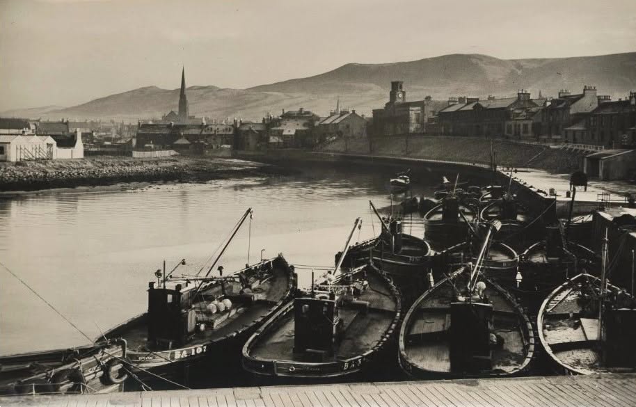
Margaret Stephen joined the working fleet. In photographs of Girvan harbour from the later 1950s, she appears among ring-netters such as Carrick Lass, Erica II and Annabelle. Peter Stephen's first order had become one of the boats using the harbour alongside its neighbours.[8]
More orders followed. The yard gave Girvan work building fishing vessels as well as operating them. Its boats went to owners around the coast, connecting the town's shipwrights and engineers with fisheries beyond its own harbour.[11]
Paying to keep the channel open
The harbour serving Noble's growing yard still needed dredging and repairs. In November 1958, MP Emrys Hughes pressed the government for help with a larger improvement scheme, arguing that it could provide work for the growing number of local unemployed.[14]
The Scottish Home Department had already agreed to meet 90 per cent of a £17,030 dredging operation and 75 per cent of £4,000 in repairs. Assistance for the larger scheme remained undecided. The approved funding shows how much the harbour's maintenance now depended on government support.[14]
Herring, trawlers and steel boats
Ring-netting caught herring by surrounding a shoal with a net, commonly with two boats working together. It was an important part of the Clyde fishery, but the fleet's work changed as catches declined and more efficient fishing methods increased pressure on stocks. Boats turned towards other fish and shellfish, including scallops and the Norway lobster usually called Nephrops or prawns in the fishing trade.[10]
In 1974, Noble's built Alliance CN187 for William C. and Robert C. Gillies of Campbeltown. She was Scotland's last newly built ring-netter, but she was also equipped for trawling. Her dual purpose gave her work beyond the herring fishery. By 1984 she was pair trawling, working with another boat to tow a net.[9]
The Clyde herring fishery collapsed during the 1970s. The change affected the kinds of boats and gear fishermen needed, while the yard itself moved predominantly towards steel construction during the 1980s. Its work expanded into vessels for fish farming and offshore support.[10][11]
The lifeboat service also needed replacement boats and facilities. In 1976, James and Barbara Aitken fouled her propeller and was driven onto rocks. She was written off as a constructive total loss. A new shore facility followed in 1993, when the Mersey-class Silvia Burrell entered service. A new lifeboat berth was completed in 2004.[6]
Another breakwater, more dredging
By June 1988, W. and J. Barr were building a new northern breakwater under a £200,000 contract for Strathclyde Region. Boulders and quarry stone were being moved onto the site of the old ruined breakwater, which had extended towards the landmark known as the red man. The work was expected to take four months.[15]
The scheme aimed to shelter the harbour from north-westerly gales and reduce the sand accumulating at its mouth. Surveys and model tests had preceded construction. The experts described in the contemporary report distinguished between material carried into the basin by the river and sand entering the mouth from the sea. Dredging was planned after the breakwater works, at a further cost expected to run to several hundred thousand pounds.[15]
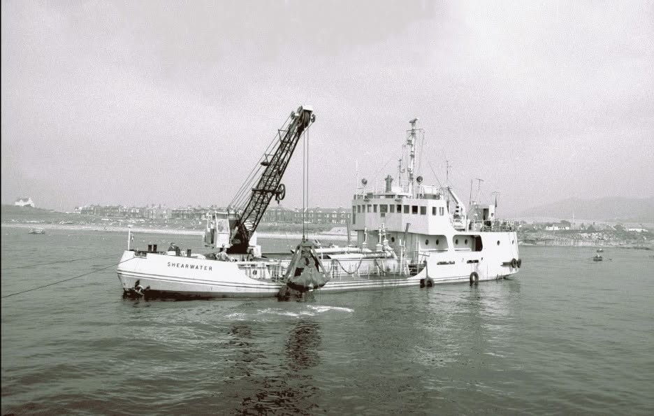
Dredging remained a recurring expense. The harbour's 2023 environmental assessment records 35,000 cubic metres removed in 1998–99, 13,300 in 2005 and 10,000 in 2010, followed by further operations. Keeping a passage open required work below the water as well as repairs to the structures above it.[16]
The Old Coal Dock has found a new use as a place to stop beside the harbour. Girvan Rotary Club transformed the former dock in 2005 to mark Rotary International's centenary. Improvements to the North Coal Dock were among projects funded by the Social Inclusion Partnership through Girvan Horizons. The landscaped site retains traces of the railway and coal trade beside its paths and planting.[19][20][21]
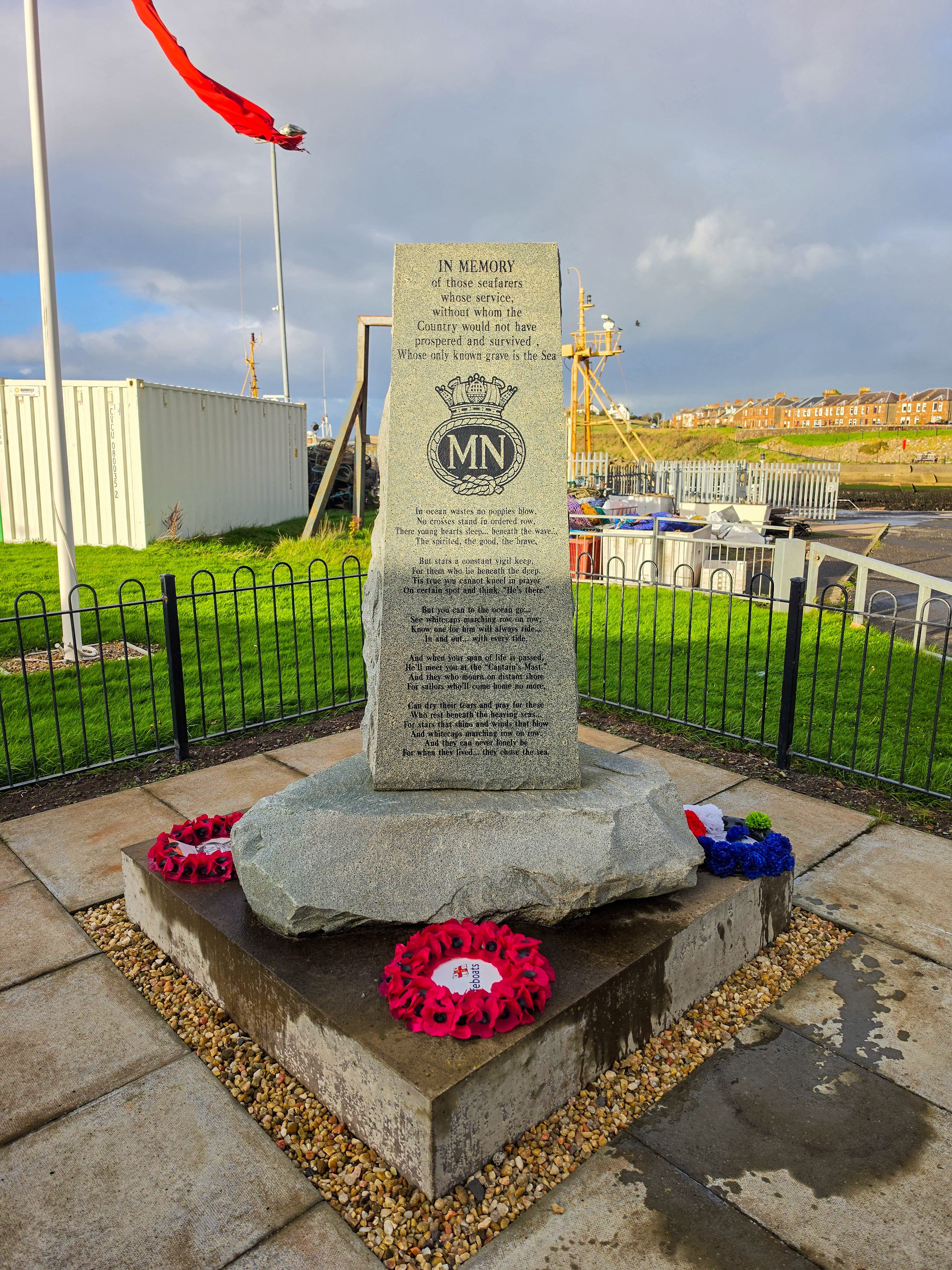
On 3 September 2023, the Merchant Navy and Seafarers Memorial was unveiled on Fisherman’s Green. Made from Ailsa Craig granite, it commemorates seafarers who lost their lives in their country’s service.[26]
Today, Noble's work centres on repairing, refitting and maintaining steel workboats, alongside boatbuilding and the repair of wooden hulls. Trawlers, tugs, barges and offshore support vessels bring different work from the fishing boats ordered in the yard's early years. Members of later generations of the Noble family still work in the business.[11]
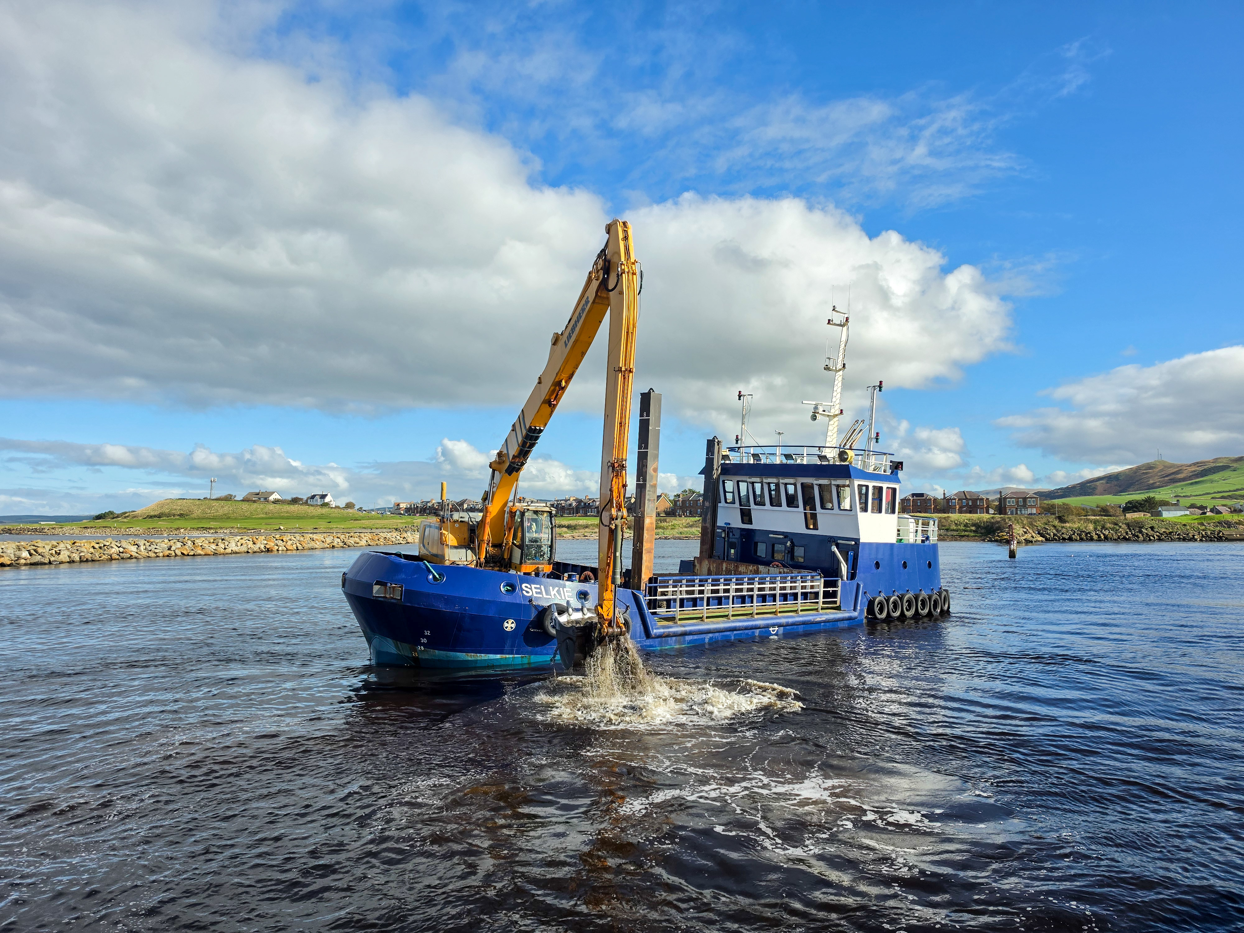
In October 2026, dredging was again under way in the harbour.[23] The council's programme targeted the main channel and the RNLI pontoon to restore lifeboat access at all tides.[24] A separate contract covered the removal of dredged material from the quayside, treatment where necessary and disposal at a licensed landfill.[25]
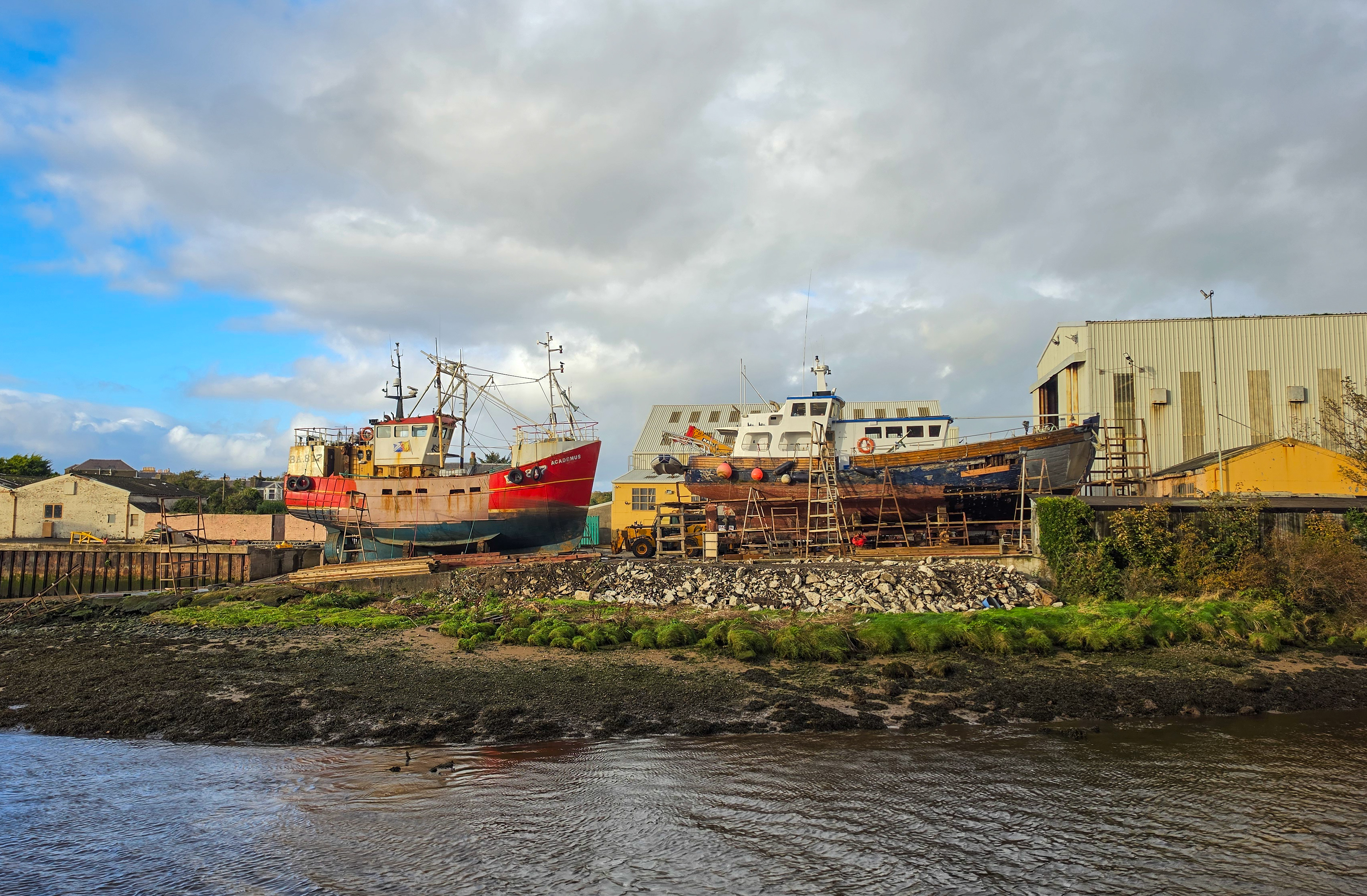
At Noble's four slipways, boats come ashore for repairs and refits. Keeping the harbour working still requires a clear route through the river mouth.[11]
Terms and context
Draught. The depth of a vessel below the waterline. A boat drawing ten feet needs at least that depth of water to float, with additional clearance for safe movement.
Harbour dues. Charges for using a harbour. The £1 annual payment discussed in 1886 was a proposal, not a confirmed tariff.
Dredging. Removing sand, silt or other material from the bottom to maintain or increase the depth of water. Material can accumulate again, so a dredged channel needs further attention.
Coal chute. A sloping structure used to transfer coal from railway wagons into a vessel below.
Harbour bar. A bank of sand or other sediment at an entrance, which can restrict the depth available to boats.
Ring-netting and pair trawling. Ring-netting surrounds a shoal before the net is drawn in. Pair trawling uses two vessels to tow a net. A boat capable of both could change its method of fishing.
Shipwright. A craft worker who builds or repairs boats and ships. Wooden hull work includes shaping frames, fitting planks and caulking the seams to keep water out.
Constructive total loss. A vessel written off because recovery and repair would be uneconomic. It does not mean that the boat was completely destroyed.
References
1. Register of the Great Seal of Scotland, vol. XI, no. 1179, 6 May 1668. James Thomson, Girvan parish account, Statistical Account of Scotland, vol. XII (1794); Peter M'Master, Girvan account written in 1837, New Statistical Account.
2. Angus Graham, “Old Ayrshire Harbours”, Ayrshire Collections, XIV(3), 1984, p. 145. Ordnance Survey Name Book, Ayrshire vol. 29 (1855–57), OS1/3/29/28, “PIER [Girvan]”; official transcription, manuscript locator.
3. National Records of Scotland, RHP22231, harbour plan, 1842, and RHP85679, proposed harbour improvements and railway connections, 17 October 1860. Pier and Harbour Orders Confirmation Act 1865 (No. 3), schedule, Harbour of Girvan Improvement Order.
4. Historic Environment Scotland, Girvan Harbour, site 203289; Francis H. Groome, Ordnance Gazetteer of Scotland (1882–85), vol. III, Girvan entry.
5. “With the Girvan and Ballantrae fishermen”, Ayr Observer and Galloway Chronicle, 12 March 1886, pp. 2–3, credited to the Mail.
6. RNLI, The Life-boat, 1 November 1894, p. 806; The Life-boat, August 1898, p. 233; Girvan station history.
7. “Inaugural Ceremonies: Scotland”, The Life-boat, vol. 28, no. 307 (October 1931), Girvan subsection.
8. “Focus on Boat Builders: Nobles of Girvan”, 10 November 2016. Scottish Fisheries Museum Boats in Girvan harbour, c.1956–1960.
9. Scottish Fisheries Museum, Alliance at Tarbert, 25 July 1984, and Alliance, 1986.
10. Ruth H. Thurstan and Callum M. Roberts, “Ecological Meltdown in the Firth of Clyde, Scotland: Two Centuries of Change in a Coastal Marine Ecosystem”, PLOS ONE 5(7), 2010.
11. Alexander Noble & Sons, company history and current services.
12. National Records of Scotland, RHP22233, 1880 improvement plan.
13. Hansard, 19 March 1886, Girvan harbour question and answer.
14. Hansard, 18 November 1958, “Girvan Harbour Improvement Scheme”.
15. “Work underway on new breakwater”, Ayrshire Post, 17 June 1988, p. 92.
16. Girvan Harbour Dredge and Disposal: Best Practicable Environmental Option Assessment, June 2023, section 2.1, p. 2.
17. Arch Henderson, “The first decade”, 15 February 2019.
18. Colin Miller, Girvan coal-chute site, RailScot, 24 October 2013.
19. John Thompson & Partners, A Vision for Girvan: Charrette Report, April 2012, p. 43.
20. Scottish Small Towns Report 2007–2013, Girvan entry, p. 84.
21. Gillian's Walks, Girvan–Turnberry–Maidens route, 10 April 2017.
22. Ordnance Survey, Ayrshire LV.4, 1909, National Library of Scotland.
23. Billy McCrorie, “Dredger at work”, Girvan Harbour, photograph taken 4 October 2026, Geograph.
24. Ayrshire Shared Services Joint Committee, Roadworks Programme 2025/26, 6 June 2025, paragraph 30.
26. Girvan Town Team, “Merchant Navy and Seafarers Memorial Unveiled in Girvan”, 5 September 2023.
Image credits and enquiries
Images are included to illustrate Girvan and Carrick’s history for educational purposes. Sources and photographers are credited where known. If you hold rights in an image, please contact us so we can review its use, correct the credit or remove it.
Pass the story on